| Motorcycle Trip -- July 2003 | ||||
| Glacier National Park, Hope B.C., Vancouver B.C., Mt Rainer, Yellowstone Still in Progress. 2/8/04 | ||||
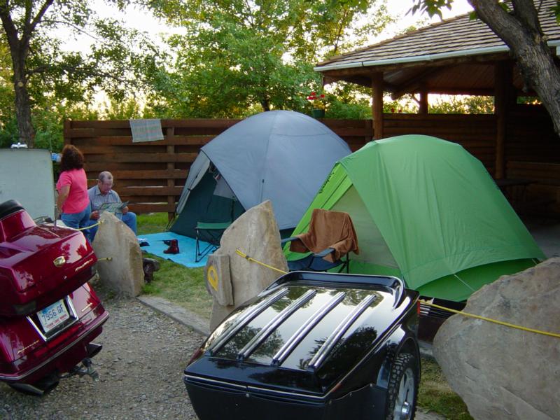
| We had a great trip this summer. I think we rode the about 2600 miles of the best cycle highways in the country. We started out Friday morning leaving Jim's place about 10 am. The ride across South Dakota was- well what can you say? Long. But at least it was not hot or humid. Our goal was Gillette Wy. but a major thunderstorm seemed to be developing in front of us so we stopped in Sundance Wy. It started raining just as we finished setting up camp.
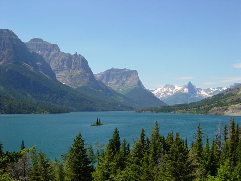
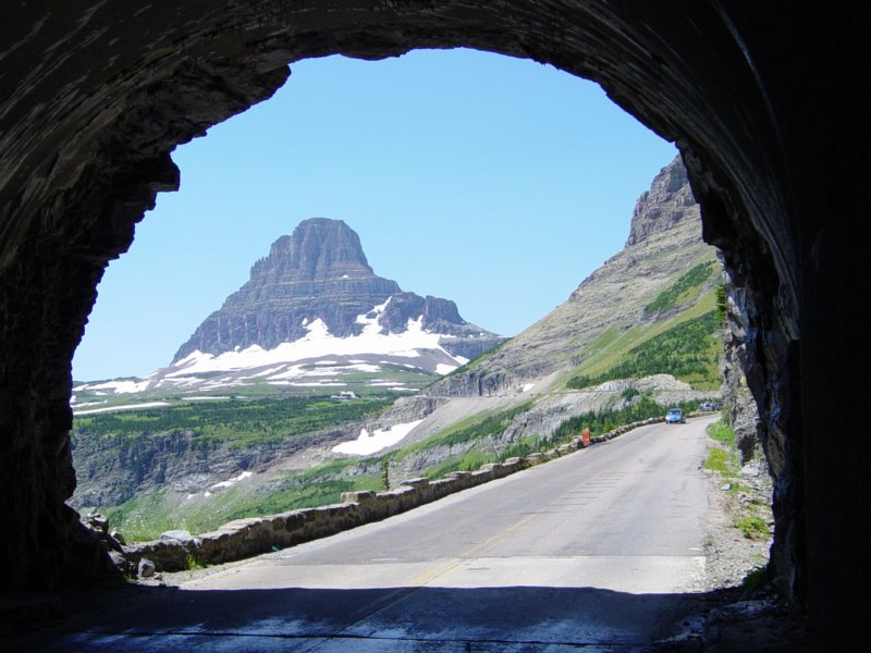
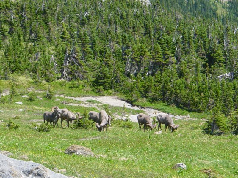
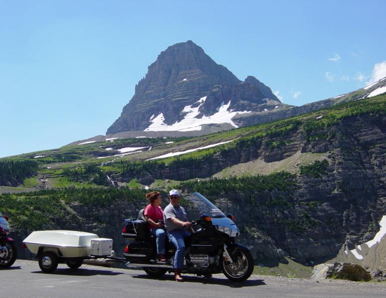
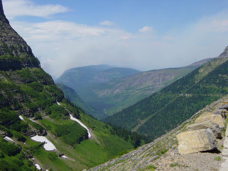
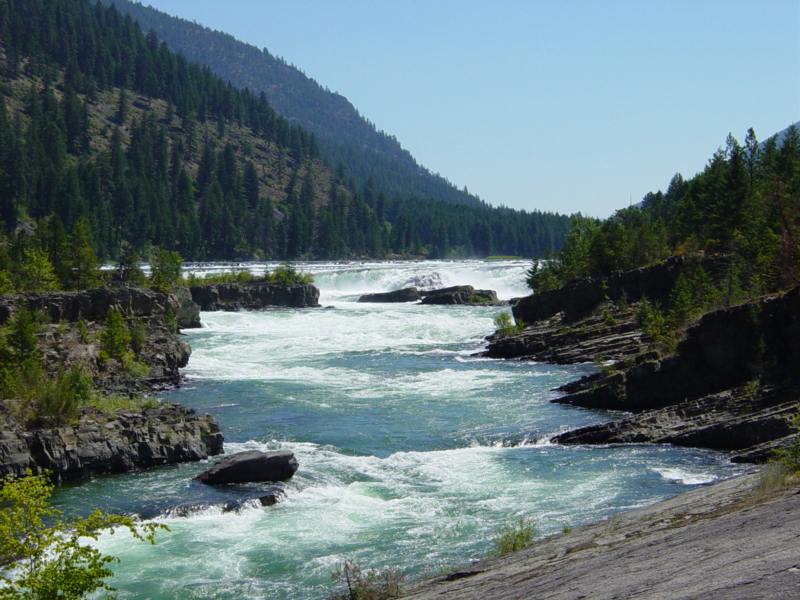
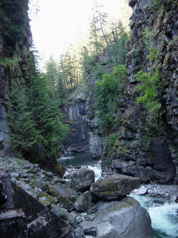
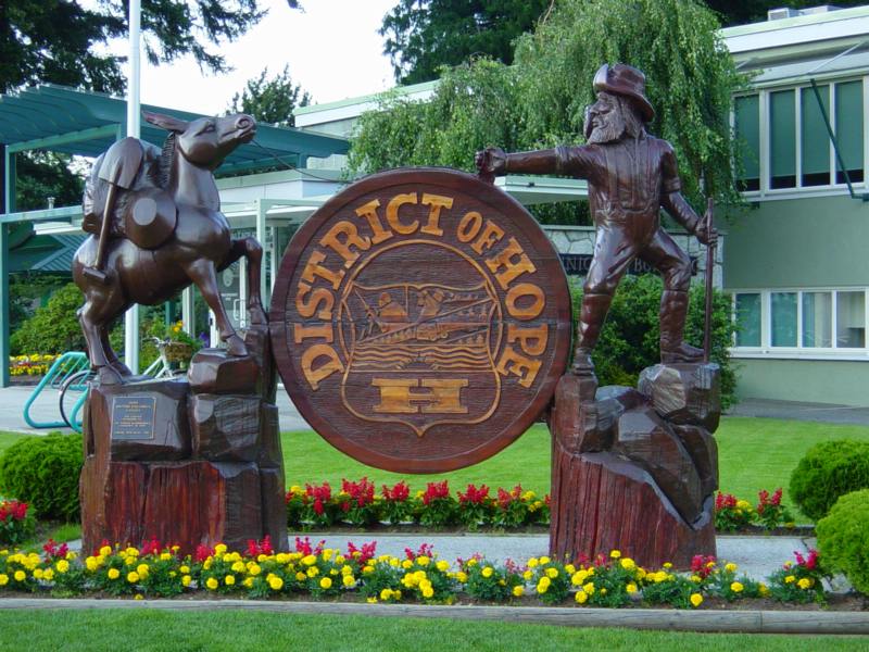
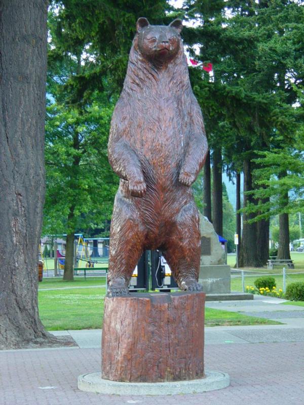
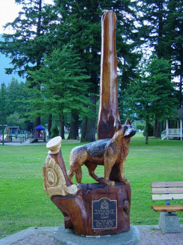
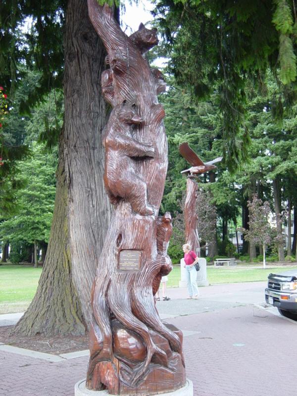
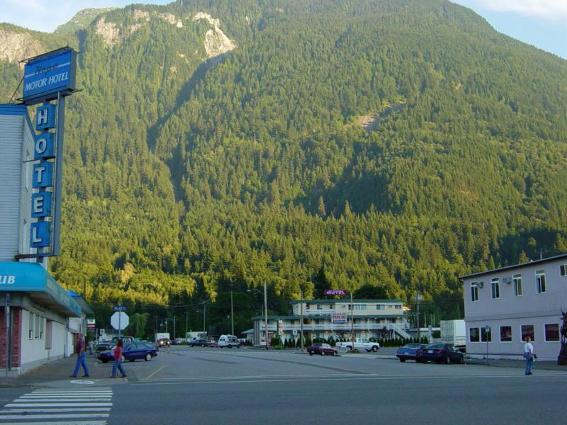
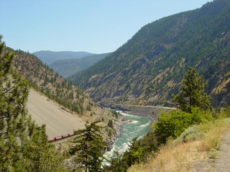
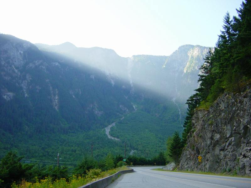
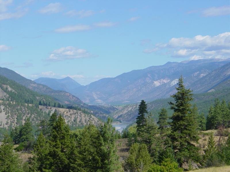
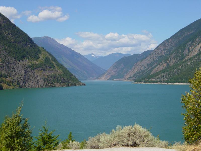
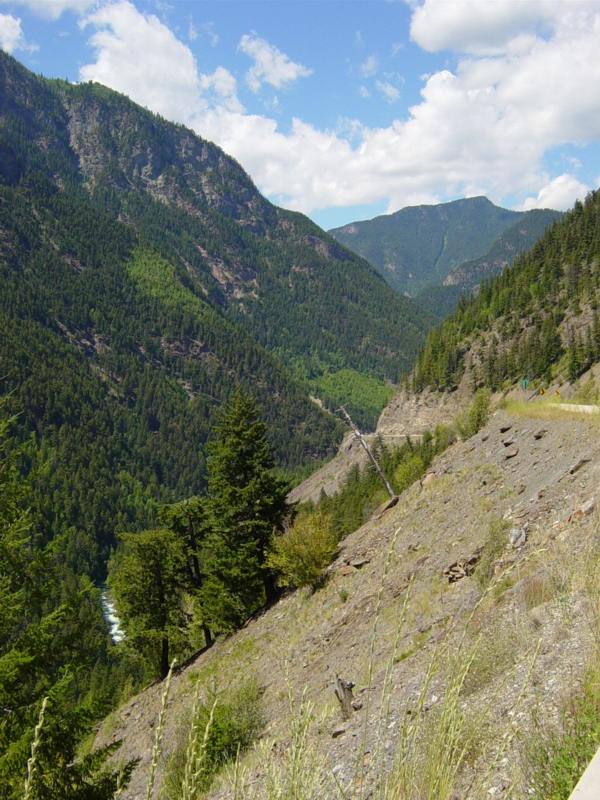
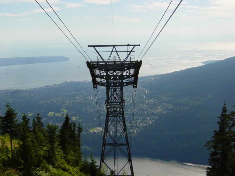
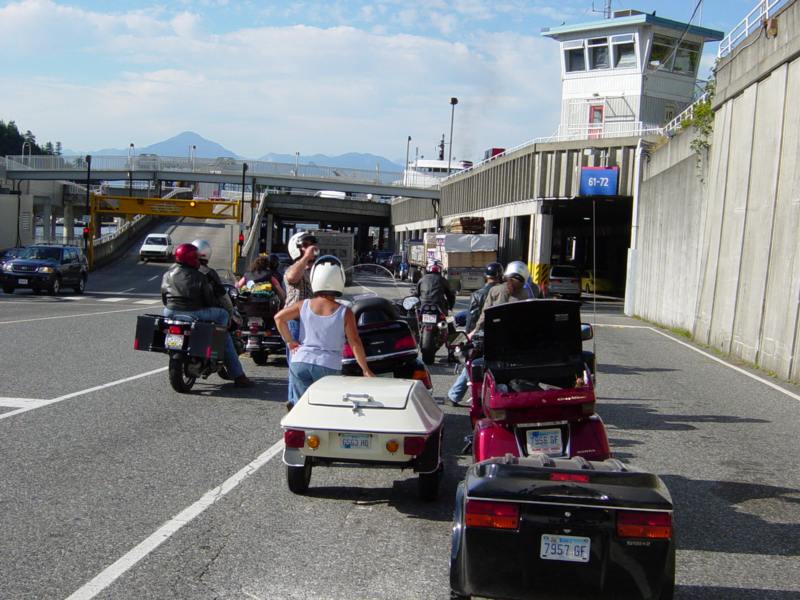
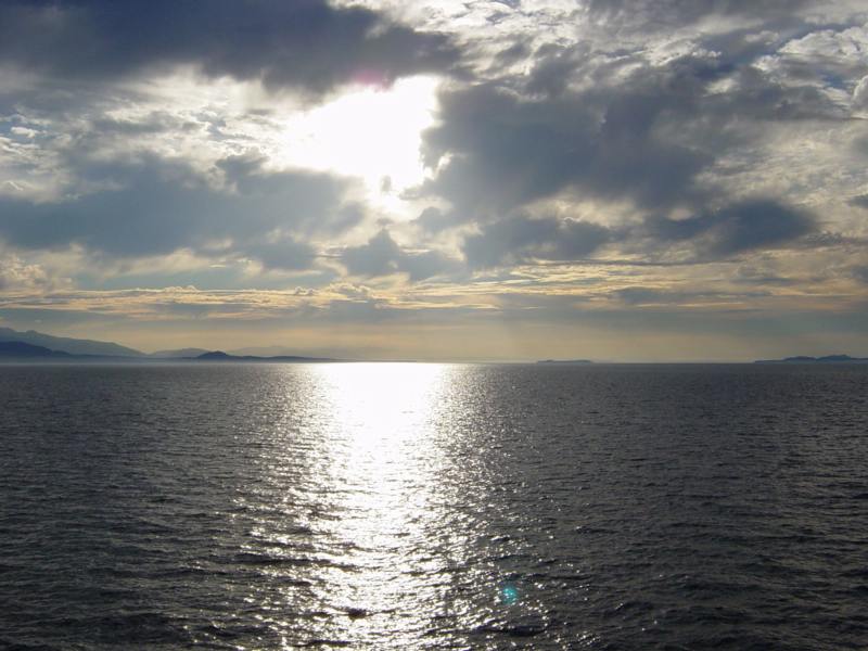
Sat: Up early and heading for Montana. By the time we made Sheridan, it was getting hot. It was 103* going through Billings. We arrived in Great Falls around 6 pm and set up camp at the KOA. Very nice place - grass and everything. I drank all the water in my cooler. Just couldn't seem to get enought to drink tonight. Sun: Heading for Glacier National Park. A gas stop in Browning. As usual, one of the locals entertainied us with his anticks??? The ride into the park is nice. Only a couple cars ahead of us at the pay station. A must-stop to view Goose Island (I wonder how many pictures I have of this place?). Several more stops before we reach the tunnel. Again, the quest for the perfect picture. Several of the local critters seem to want parking space in the lot at Logan Pass. Pause for a photo of Jim and Von at the top and then start heading down the West side. The slope down to the Valley below is really spectacular. Down the West side. Wow, what a view. We can see the smoke and a few flames from the forest fire off to the Southwest. (eventually, this fire blows up into a major blaze resulting in the closing of the park). We camped in a KOA just west of West Glacier. Mon. We adjusted our route and took off for Libby Mt and then into the Northeast corner of Idaho. Crossing the boarder into Canada at Porthill. We gassed up at Creston and then started West on highway 3. The farther West we went the more scenic it became. We have been following a river for several hours now. We stopped at a park to take a hike over a suspension bridge. Then moved on to Castlegar. Along the way the smell of smoke was strong at times and one could see smoke clouds in the distance. We stayed in a small private campground in Christina Lake Tue. Through the Midway Mountains and then into the farming region of Osoyoos. Fresh fruits and vegetables. Hot. Very hot. On up to Princeton then a long sweeping road that passes through a Provintial Park and then drops into Hope. What a ride. We camp at the KOA, then head for the 'tunnels'. Busy place. Another movie is being filmed here (Bioharzard). We learned the people of Hope are very proud of their movie heritage (as they should be) but are working hard to promote their community as the "Chain Saw Capital of the World". Carved (sawed??) sculpters can be found along all of the streets downtown. I really like the bear, the police dog, and the bear cubs climbing a tree. The entire community of Hope is surrounded by mountains. Wed. A side trip up to Merrit. The road (Hwy 29) out of Hope is steep and very scenic. My speedometer cable breaks at the toll booth. Bummer. On to Merrit and then over to Spences Bridge. This area is almost a desert. South on 97 along the Frazer River to Lytton and then on to Hells Gate. We get back to Hope in time for supper and a chance to wander around downtown. Thu. Back up Hwy 97 (looking back toward Hope - very steep road) to Lytton and then across the river to Hwy 12 heading for Lillooet. Now this is a awesome road. Up and down, parts just hanging on the side of the mountain. The valley is mostly farming but don't get to close to the edge. It's a long drop to the river. We stop at Seton Lake to rest and then head Southwest to Mt. Currie. Totally scenic. Steep mountain roads, lakes, rivers. Wow, such views. We stop at Nairn Falls Prov Park with the idea of hiking to the falls. The mosquitoes are just awefull. (the only place we experienced bugs the entire trip). By the time we reach Whistler, it was getting very hot again (100*). Wow was Whistler a busy place. On down to Squamish to find a campground. Right on the ocean with a high cliff to the East of us. The cliff has a 260ft waterfall. Fri: Some 'local' bikers we met at the campground told us how to get to a Honda shop so I can replace my broken speedometer cable. Their directions were very easy to follow. Well, up to a point. We ended up under the bridge at a dock. Finally we found the shop. They were very helpful but we had to wait 3 hours for the part to show up. Once installed, back across the city to Grouse Mountain. A quick ride up the gondola and we had a good view of the city below. Time to head to Vancouver Island and find a place to stay. We gas up and head to the ferry terminal. I notice that my speedometer cable is broken again. Wow!! Is that the line for the ferry? Geez, it's backed up about 2 miles. Fortunately motorcycles take up little space and are allowed to go to the front of the line. We drove right up, paid our fees and barely had time for a soda before we boarded. The trip over was great. It got very windy as we approached the island but then the wind suddenly quit. What a beautiful sunset. We set up camp in the dark at Nanaimo. Sat: |
||||
Still working on this part. Sorry. Check back soon.
We were as far west as our bikes could takes us so we started back toward home. This meant taking a ferryboat back to the mainland (plan ahead because they fill quickly).
We took the Interstate from Butte to Bozeman, then turned South to Garner to take a side trip through the top part of Yellowstone. I've been to Yellowstone several times but have never toured the northern part. The road in is fun and Gardner is an interesting place. It started drizzling so we picked up the pace in hopes of getting to Mammoth Hot Springs before it started poring. Wow, what a disappointment. There isn't much left of the Springs except a large dirt pile. You can really see the effects of the fire also.
We left Yellowstone by the Northeast gate. The road is in "ok" condition and has some fun curves. It started to rain and sleet by the time we got to the entrance. Not far from the entrance area is a small resort area. It could be an interesting place to stop but the temperatures now suggested a much lower altitude. The road from the Northeast gate down to Cody is just great. These are real "cowboy" mountains with deep gullies and bare rock.
After a night in Cody, we decided that this may be a good place to spend more time next year. Roaming the roads and visiting with the people. I hope your travels were as enjoyable as mine.