
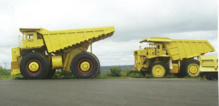
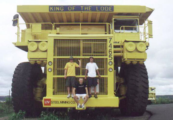
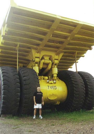
From Virginia, we travel to Sudan Mn. to tour the underground iron mine. If you are ever in this area, you must do this tour. It is a tremendous experience.
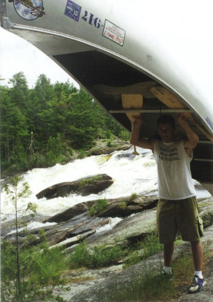
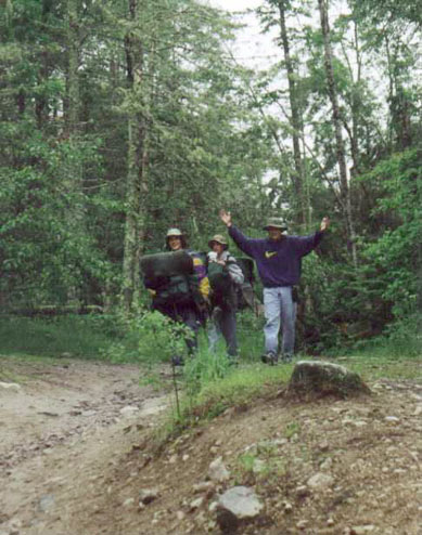
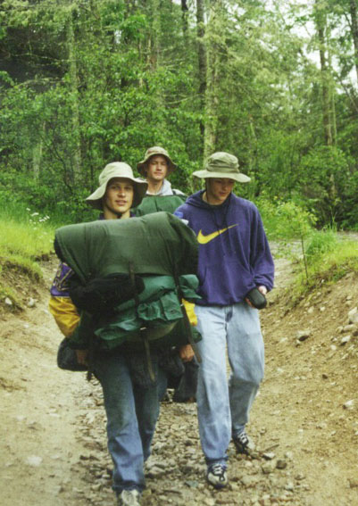
After spending a night at Cliff's campground and having a quick breakfast, we are off to Fall Lake to launch our canoes. The trip to the West side of Fall Lake was an easy paddle interrupted with an occasional light rain. To get from Fall Lake into Newton Lake requires caring all of the packs and canoes across a path called a portage. To save time and effort (so they say) one person carries the canoe and another double packs, meaning putting a pack both on your back and your front. At times though, someone finds a way to pack light - right Cole! Someone has to get that camera case over the portage.
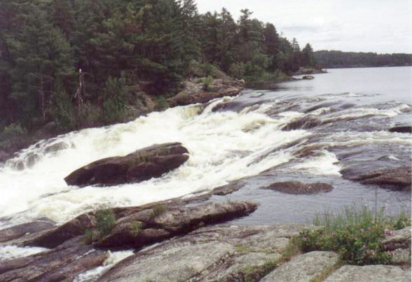
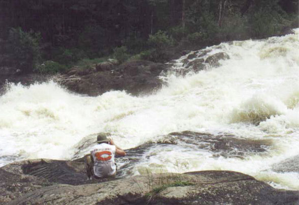
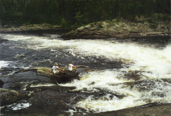
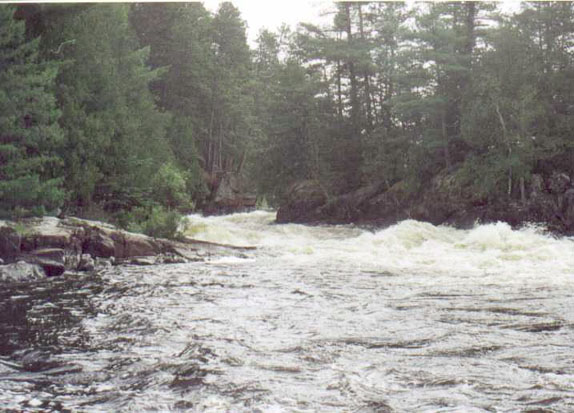
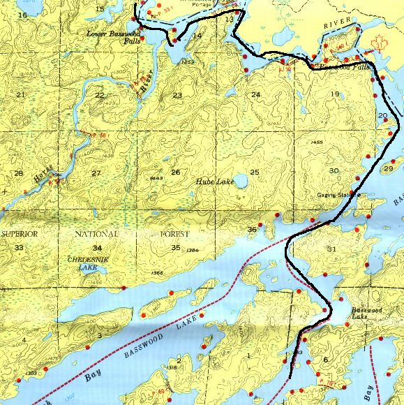
One of the reason for a portage is that the lake opens into a river which may contain to many rocks to make it passable or a water fall. Basswood Falls has a very long portage around one large falls and several small ones. The total length of the "walk" is just over one mile over dirt and swamp trails. The larger falls, is very fast moving and very dangerous. Of equal danger is the smaller falls and rapids that some fools try to paddle.
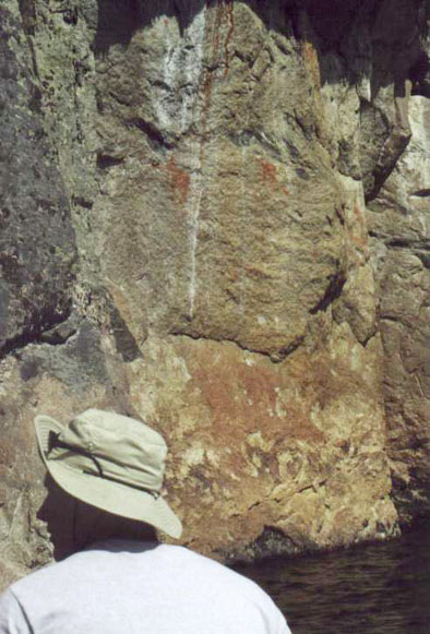
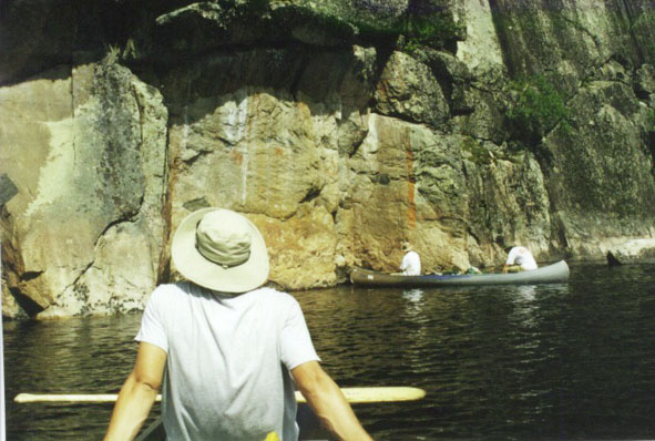
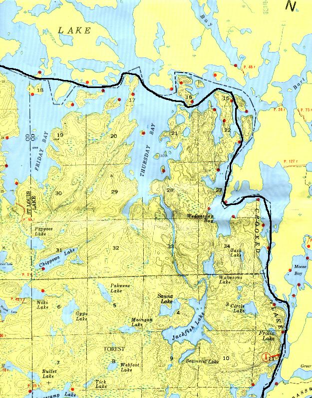
Not far downstream from Basswood Falls on large flat walled cliffs are Indian pictographs. It's amazing to me that these pictographs have lasted over one hundred years and we can't keep paint on the house for more than two years.
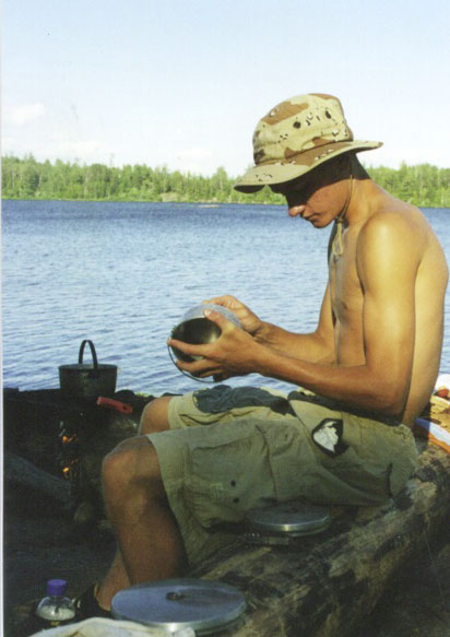
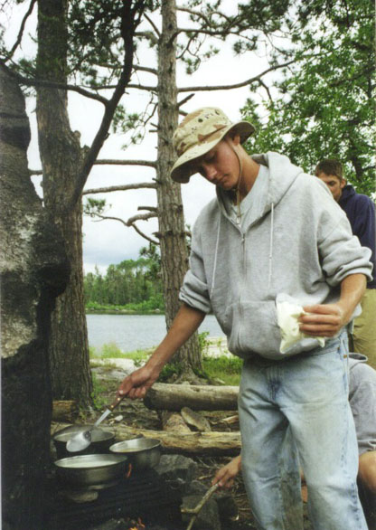
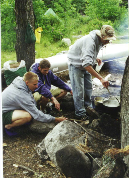
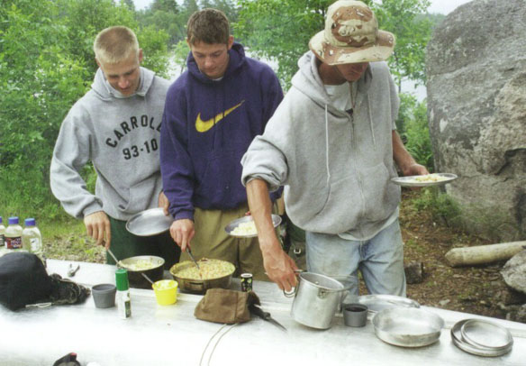
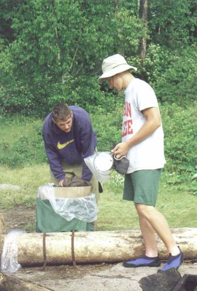
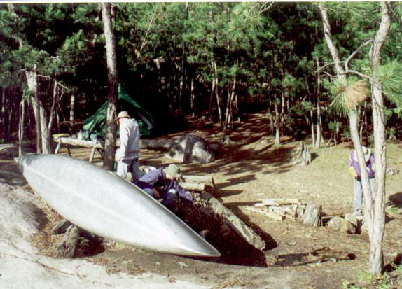
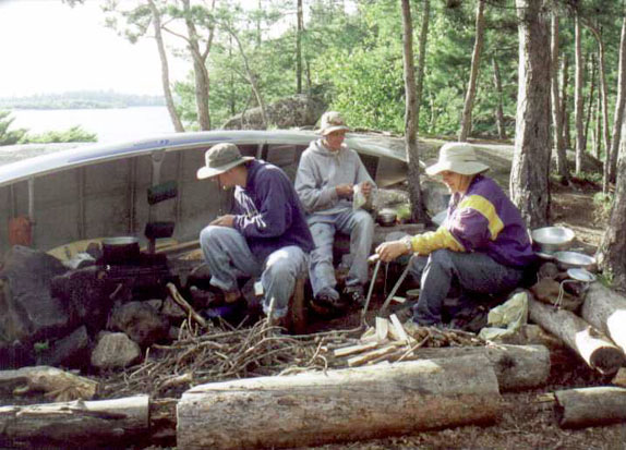
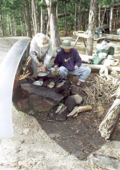
Setting up camp requires unpacking the packs, setting up the tent, gathering wood, and cooking the meal. In these pictures you can see Landon soaping a pot to make it easier to clean and starting supper while Cole and Craig add wood to the fire. Once everything is ready, you step up to the "table" and fill your plate. Braking camp is also a task. Here Cole and Craig begin packing the "kitchen" pack.
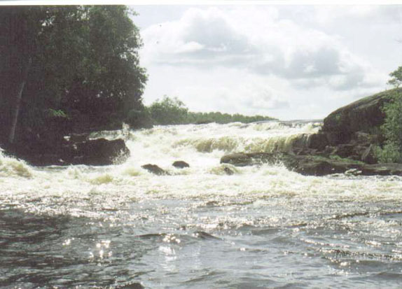
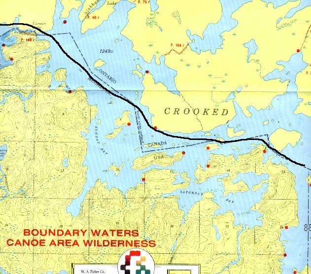
We had several water falls and rapids to portage around this year. Curtain Falls is actually two falls split by a large rock. The Canadian side is longer and fast moving while the US side drops quicker. Cole and Landon thought they would paddle over to the US side for a closer look and found that the water may be moving away from the falls but the current actually pulls your toward the falls.
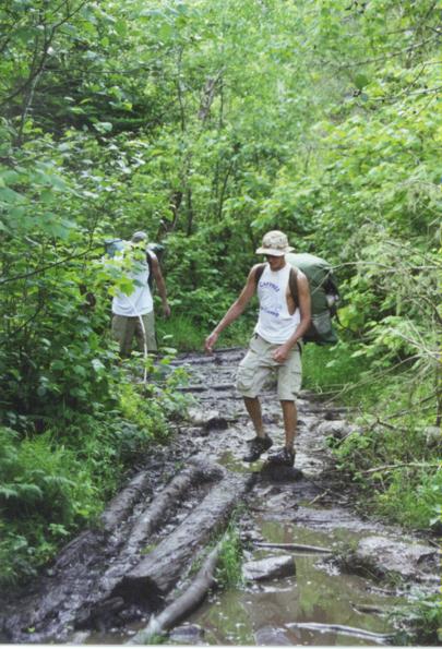
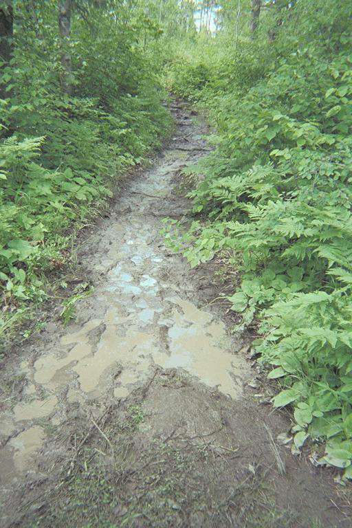
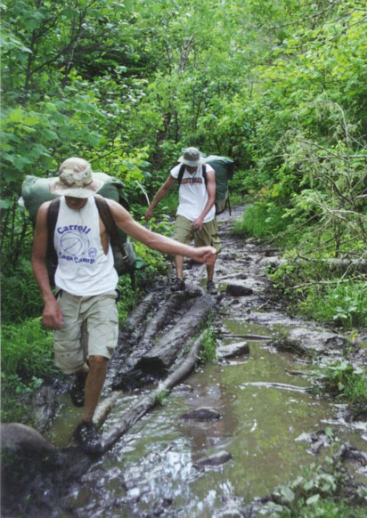
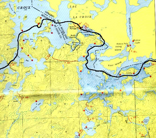
Not all of the portages were a nice walk (actually only two were). The portage around Bottle Rapids is known for it's mud and mosiquiotes but this year, it surpassed its reputation. In these two pictures, you can only get a small idea of how "damp" the portage was.
The second to the last day out became very windy so we took a campsite early. We had just started setting up camp when a major squall came up. Once the squall passed we finished setting up camp and started making supper. Notice how we used the canoe as a windbreak. Craig became master woodcutter while Landon did the cooking.
Turning South our last day we paddled into a large lake, then through two smaller lakes and then into a small river- the Nina-Moose river. While paddling up the river, we spotted moose and several bald eagles.
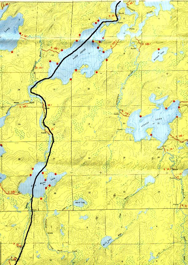
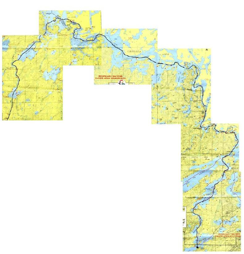
You can follow our trip by clicking on the following map links. Caution, most of these map files are about 150K. Map 1 traces our route from the Fall Lake landing almost to Basswood. Map 2 starts at our noon lunch point and turns Northwest forcing us to portage over Basswood Falls (1.1 mile portage) and after a short paddle we camped for the night. Map 3 takes us North through a narrow series of lakes past pictographs and "Table Rock". Then we turned West into Crooked Lake. It was here that we saw the bear. We camped on an island on the part of Crooked Lake. Map 4 takes us across Crooked Lake and over Curtain Falls. Map 5 does not seem to display all of the "rocks" and islands that can be found in Iron Lake. We camped on the North shore of the lake. The next day we portaaged into Lac La Croix forcing us to cross over Bottle Portage. The stsrong winds forced us to camp early on an island across from Warrior Hill. Map 6 takes us South into Lake Agnes, Nina-moose Lake and finally into the Nina-moose river.